This section contains entries about our botanizing in Baja California written for the UC BEE (Oct 2012 to Aug 2021)
and The UC Bee Hive (2022-), monthly newsletters for volunteers and staff of the UC Berkeley Botanical Garden.
Click on any photo for a larger image.
BEE HIVE SEP 2022
San Borjitas Archeological Site, Mulegé, BCS
When there’s not much happening botanically in a dry landscape such as here along the central coast of the Gulf of California, an active mind like mine needs something to keep it occupied. So in March 2022 it was off to cover new territory in the sierras with my friend Javier, and visit the rock art at nearby San Borjitas.
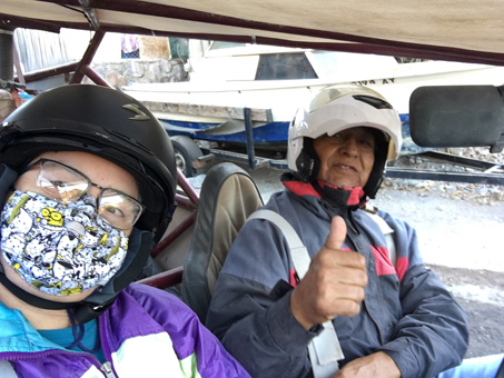
Ready to hit the highway, northward to Palo Verde.
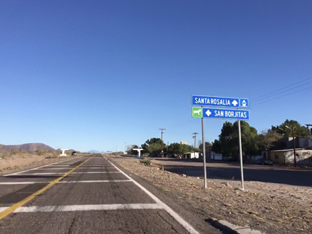
Palo Verde near the turnoff to San Borjitas at Km 157.
Once we had signed in with the INAH representative Everardo (also our guide for the day) in Palo Verde and got back on the highway, the trip took just a little over an hour to the staging area and trailhead. That didn´t include the 15 minute stop to change a shredded tire.
The site is located in the Sierra Guadalupe at an altitude of about 530 meters (1739 ft). Currently the road is in excellent shape, the majority of it having been recently graded. Only the last couple of kilometers, once you enter the locked area of the archeological site, are rougher, narrower and rockier, but that part took just 10-15 minutes in Javier’s buggy.
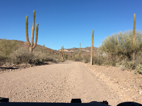
Practically smoother than some parts of the highway. We were headed for Arroyo El Perdido (lost arroyo or arroyo of the lost), but we had our official guide so I was confident someone knew the way there and back.
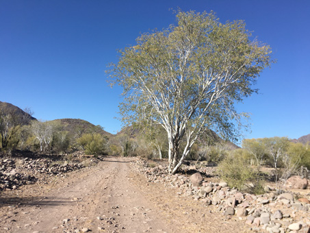
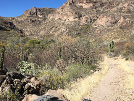
Heading westward early on in the trip. Lots of Palo Blancos (Lysiloma candidum, Fabaceae) crowd the arroyo beds all the way.
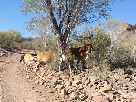
The cows were a little jumpy around the unexpected motorized visitors at this early hour. We were probably now, or soon to be, heading up Arroyo Baltazar.
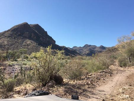
Once we entered Arroyo San Borjitas through a locked gate, the road became a little narrower, as well as rougher in a few spots.
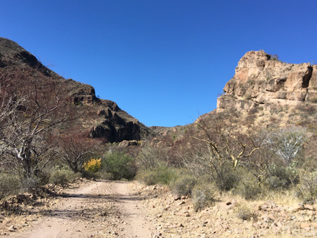
Once in Arroyo San Borjitas, we were closing in on our destination.
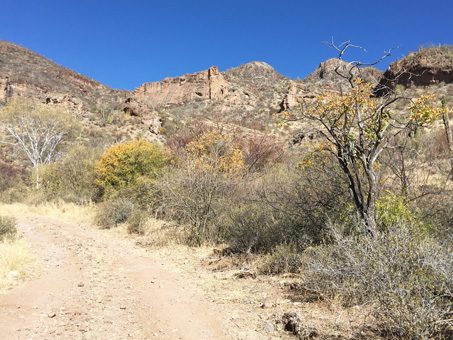
The yellow trees are Arrow Poison Plant / Hierba de la Flecha (Pleradenaphora bilocularis, Euphorbiaceae) as well as some Palo Zorrillo (Esenbeckia flava, Rutaceae).
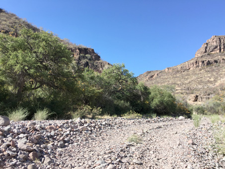
Just a little more and we'd be there. I had no idea at the time that it was just around that next bend in the canyon. I was just enjoying the ride.
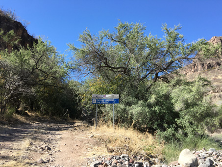
Entering the archeological site. The sign (translated) says: San Borjitas Cave Paintings.
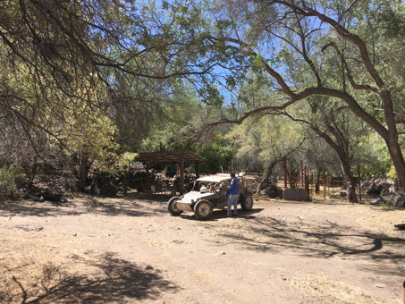
Our trusty buggy and pilot. Lovely shaded area with a picnic table.
From where we parked, we walked up the southwest side of the canyon on a trail that climbed 50 meter (160 ft) over about 700 m (0.4 mi). It was a bit loose and slippery (especially noticeable on the return trip downhill) and as we went up, the cliff below us to our right got higher and the edge closer.
Early on, Javier had asked our guide how long the hike would take and Everardo said normally about 20 minutes but, pointing back at me straggling behind, said it would more likely be about thirty! So with cane in one hand and an occasional gentle push on my knapsack from behind by Javier whenever I seemed to lose my forward momentum going up some rock, or listed to my right, I was determined to limp my way up (on ever more trembling legs) and we did arrive in the predicted amount of time.
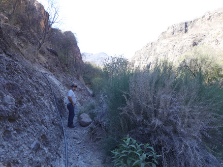
Passing by a small pool, crowded with Southern Spiny Aster / Buena Mujer (Chloracantha spinosa var. spinosissima, Asteraceae)
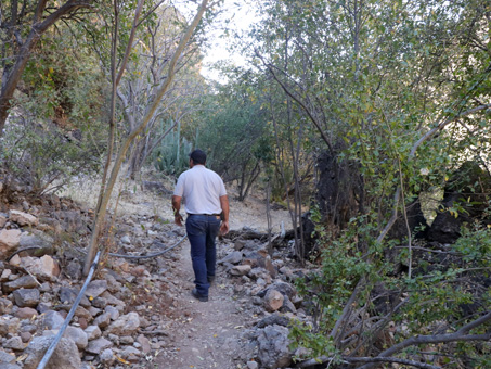
A nice shady area, with lots of undergrowth. Though plants were green and some had flowers, it was fairly dry on the hillside.
Of course, in my defense, my upward progress was also slowed by the plants I saw along the way. I had to stop every so often to take a photo so I’d have a visual inventory of what I’d seen (instead of written notes). As I was walking, I started to name a few of the plants I recognized in Spanish and our guide Everardo would nod his head. For a while, he’d stop and point at a plant and wait for my response, nodding when I'd identified it, then moving on.
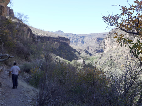
At this point, I was very happy to learn this was the top of the trai and we didn't have to walk all the way up the arroyo seen in the distance.
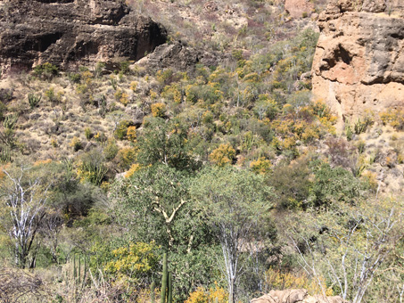
The trees and shrubs below and on the other side of the arroyo were lush and colorful. The yellow is mainly from the dying leaves of Palo Zorillo (Esenbeckia flava, Rutaceae).
Cueva San Borjitas — I can't believe I made it!
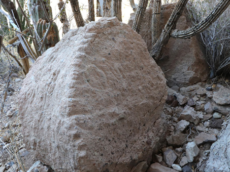
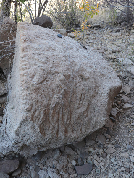
Just on the other side of the locked gate, there were petroglyphs (engravings) on what appeared to be two halves of a broken boulder. Others were to be found at the mouth of the cave. They were all repetitive geometric shapes in the form of “yonis”, representations of the female womb.
On first approach, the site didn’t look at all as I had envisioned it from photos my partner had taken years ago on a trip with friends, back when the road ran mostly along the rough, bouldery arroyo bottom, so I was unable to tolerate the trip. First off, I didn't remember that they'd said they had to hike up a canyon and that it was perched on the side of a cliff. But as I got closer, it started to look familiar and the scale of the cave gradually became more evident.
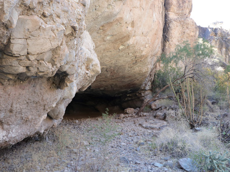
Not particularly impressive from afar...
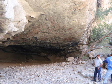
... until the guys stepped into the frame.
The rock art site has been estimated to be about 7,500 years old (though the age is much disputed in the scientific community). It was created by generations of prehistoric hunter-gatherers who migrated seasonally between the Gulf coast and the Sierras. See Cave Paintings and Cowboys on my website for a more detailed description of the art and various sites on the Baja California peninsula.
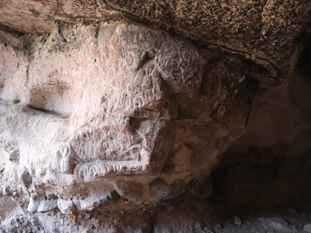
More yonis nearer the mouth of the cave.
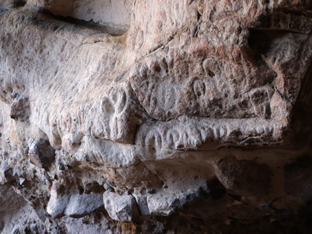
The yonis up close.
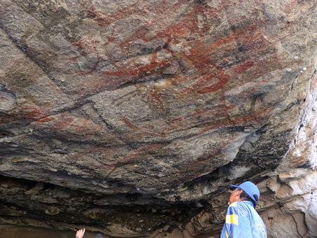
The pictographs (painted images) are representative of the Great Mural style from central Baja California. Images on the cave ceiling and walls were located high above our heads (4-5 m in some places) and were mostly about life size or smaller, with many superimposed to the point of it being difficult to distinguish the subjects. Among the images were monos (anthropomorphic figures), chamanes (shamans) with headdresses, a coyote, a turtle, several fish and many deer. The colors were primarily black and red, but there was one white mono that looked kind of like an alien, and a yellowish animal, perhaps a coyote or puma. Unfortunately, many of the paintings deeper inside the cave where the ceiling was lower where more damaged, mainly by soot from fires on the floor of the cave.
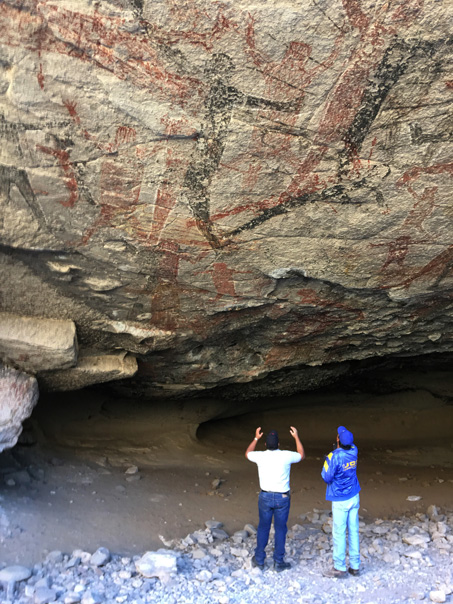
Left side of the main section of the paintings.
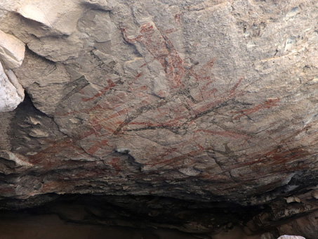
A little more to the right of the previous image. All in good shape.
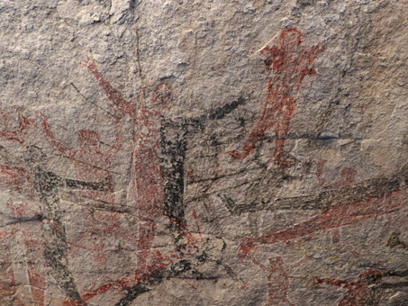
Overlapping of images, distinctive of the Great Mural Style. 'Monos' and animals are depicted here.
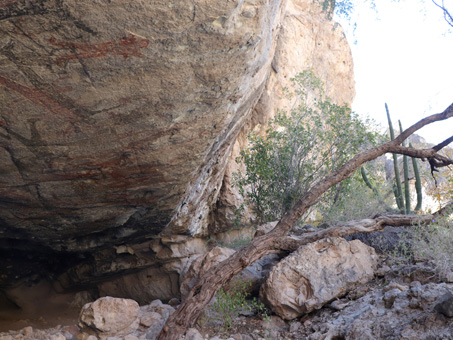
Because of the curvature of the cliff, sheeting rain and storm runoff from above can run across the face of some of the paintings. This has led to rock erosion and loss of clarity of some of the outer paintings.
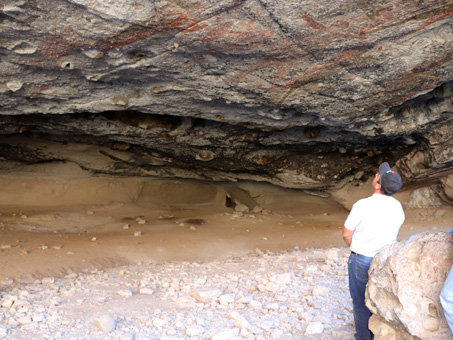
Rain from past hurricanes has also flowed across the cave bottom. Some artifacts have likely been swept away (and carried off) over the years.
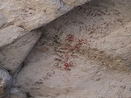
A small pictograph is badly weathered close to the cave opening.
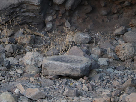
A grinding stone or mortar, known as a metate in Mexico.
I didn’t have a great deal of time on the six hour roundtrip from Mulegé to look at plants. We’d picked up our guide at about 8 am, and had to get him back at a decent hour in the afternoon, so I only had a little bit of time on the hike up the hill to the cave and after a quick lunch to check out the plants in the area. So just slim pickings this month.
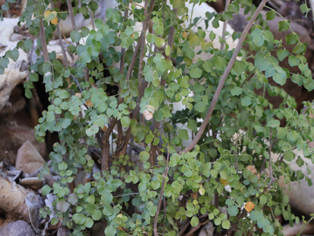
Carter Torchwood (Amyris carterae, Rutaceae). Apparently this is a rare shrub endemic to this small section of mountains west of Mulege and the more encompassing Sierra la Giganta, of which it is a part. It caught my eye as an unknown, mainly due to the large pinnate leaves.
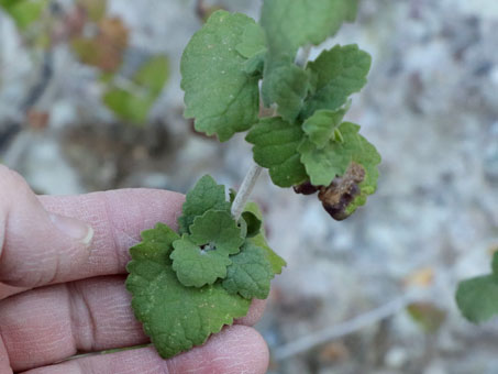
Baja California Beebrush / Poleo (Aloysia barbata, Verbenaceae). The herbage is aromatic and almost minty. The flowers are small, funnelform and yellow.
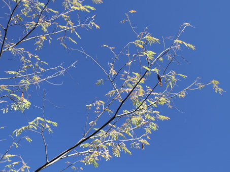
Mauto (Lysiloma divaricata, Fabaceae). This is a relative of the Palo Blanco (L. candidum) which is prominent in the Sierra de la Giganta as well as desert arroyos and slopes southward from Santa Rosalía.
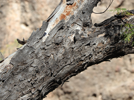
Mauto is uncommon and limited to higher elevations at this latitude, and becomes more abundant farther south on the peninsula, especially in the mountains of the Cape Region.
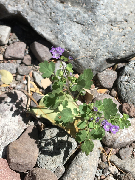
Sticky leaves with a skunky smell? It's gotta be Rama Zorilla (literally 'skunk branch') — Phacelia scariosa (Hydrophyllaceae). But the purple flowers of this native are exquisite in their arching scorpiod cyme.
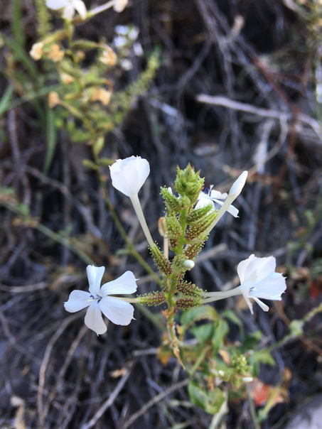
Doctorbush / Hierba del alacrán (Plumbago zeylanica, Plumbaginaceae). The calyces are really cool, with long stalked glandular hairs. The anthers are a lovely blue. Perhaps this bush helps treat scorpion (alacrán) stings? It seems to be widely used medicinally.
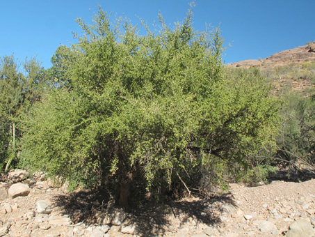
I was glad I remembered to ask Everardo about one particular tree we’d seen back at the parking area, one whose identification had eluded me since I started to go on trips with Javier to the sierras. Habit, bark, leaves and fruit just weren’t enough to key it out. But Everardo was able to give me the local name, Bebelama, and I was able to go right to it (Sideroxylon occidentalis) in the Baja California Checklist (Rebman, et al. 2016).
This is a small Bebelama (Sideroxylon occidentalis, Sapotaceae). The one by the parking area was about 8 m H).
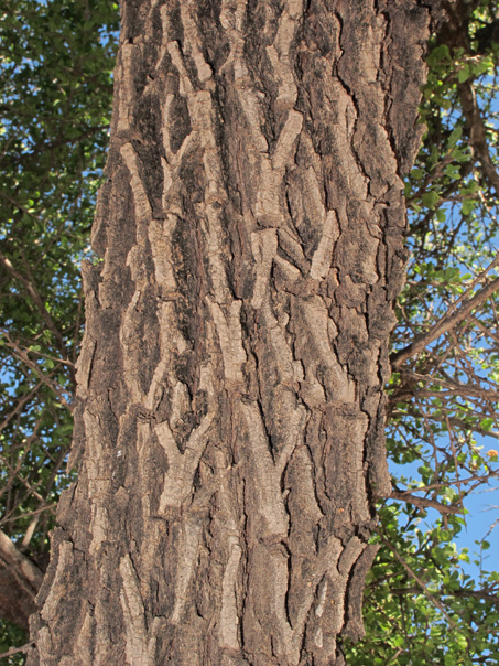
The gray (in my opinion chocolately brown in this area) bark is quite distinctive, with deep, wide furrows.
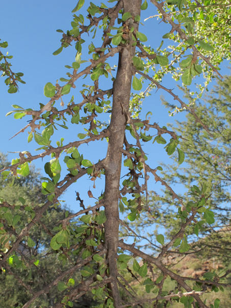
The stiff, spreading branchlets have short side-shoots and sharp spines. The 1-3 cm fascicled leaves can give the spreading branches a pipe-cleaner look.
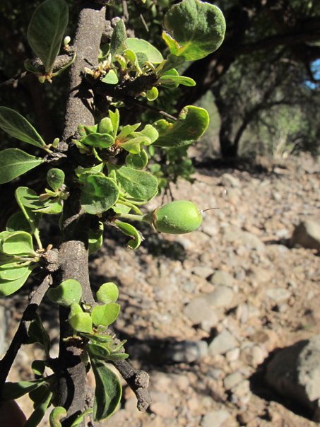
The small drupe is 1-1.5 cm D, green when immature and (blue-) black when ripe. iNaturalist has more photos of the species.
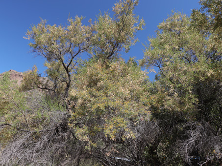
Peninsular Acacia / Huizache or Palo Chino (Senegalia peninsularis, Fabaceae) is an endemic shrub or tree. This tree was about 8 m tall.
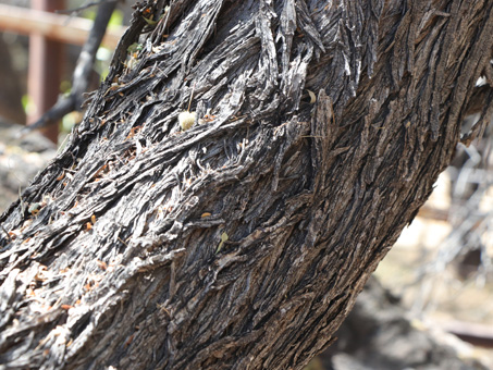
Around Mulege, at or near sea-level, it is usually more of a shrub and only about 2-3 m tall. Here, it rivaled the tallest of the Mesquites and Bebelamas.
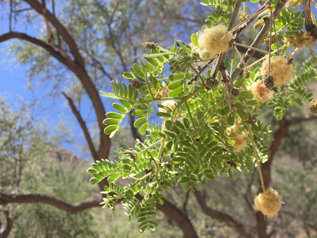
It can be found from around San Ignacio and southward to the Cape. Leaves are bipinnate, with 1-2 pairs of pinnae and 2-8 pairs of leaflets.
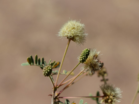
The tiny flowers are in globose to ovoid heads 1.5-2 cm D. It has unguiculate (curved) stipular spines (bottom left on stem).
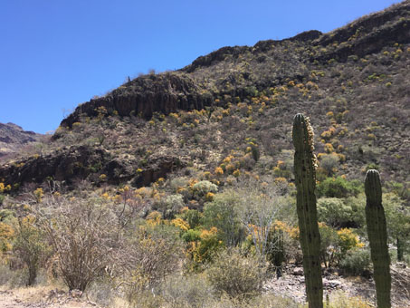
Once we returned to the main road, out of the locked area, we headed to Rancho Baltazar to sign in and pay the small fee required by INAH. More yellowing Arrow Poison Plants and Palo Zorillo add color.
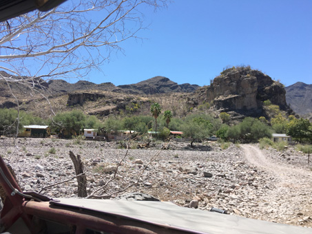
Rancho Baltazar. In addition to hiring Everardo out of Palo Verde, visitors can go directly to the ranch to hire an official guide for the trip to San Borjitas.
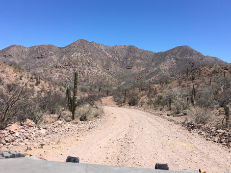
Homeward bound back to the highway.
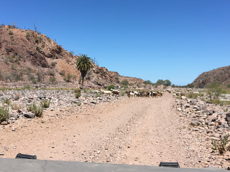
Traffic jam in the arroyo.
We've come to the end of this entry. I hope you are enjoying the added cultural information along with the plants. I've always wanted to see San Borjitas but the road was always an issue, so I'm very happy that this turned out to be the perfect year. Next entry, it´s more cave art adventures, this time at Santa Martha in the southern Sierra San Francisco...on a mule...¡arre! (giddy up). Until then, hasta luego...
Debra Valov—Curatorial Volunteer
References and Resources
Rebman, J. P., J. Gibson, and K. Rich, 2016. Annotated checklist of the vascular plants of Baja California, Mexico. Proceedings of the San Diego Society of Natural History, No. 45, 15 November 2016. San Diego Natural History Museum, San Diego, CA. Full text available online.
Rebman, J. P and Roberts, N. C. (2012). Baja California Plant Field Guide. San Diego, CA: Sunbelt Publications. Descriptions and distribution.
Valov, D. (2020). An Annotated Checklist of the Vascular Plants of Mulegé, Baja California, Mexico. Madroño 67(3), 115-160, (23 December 2020). https://doi.org/10.3120/0024-9637-67.3.115
Wiggins, I. L. (1980). The Flora of Baja California. Stanford University Press. Keys and descriptions.


