This section contains entries about our botanizing in Baja California written for the UC BEE (Oct 2012 to Aug 2021)
and The UC Bee Hive (2022-), monthly newsletters for volunteers and staff of the UC Berkeley Botanical Garden.
Click on any photo for a larger image.
BEE DEC 2018
International Border to Mulegé, BCS
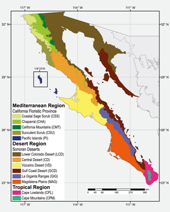 We hit the road, heading south for Baja California in mid October. I am hopeful for a good season of botanizing, because of the ample rain that has fallen throughout the Summer and into October. We were ready for travel delays as there was word of several storms lining up out in the eastern Pacific. Even though Hurricane Rosa had weakened to a remnant low by the time it crossed the peninsula on October 2nd, the rain it brought took out numerous bridges and stretches of road along the eastern coast of the peninsula north of Bahía de Los Ángeles due to flash flooding. Luckily though, by the time we reached central Baja California, any danger was well past and there were no delays from any of the washouts that there were.
In this entry are images from across the peninsula as we made our way south and once we arrived at our final destination of Mulegé, including: the Central Desert, which extends from near El Rosario to beyond the 28th parallel, the border of Baja California Sur (see orange area on map); the Vizcaíno Desert, which begins north of Guerrero Negro on the Pacific side and extends southward as well as eastward to near San Ignacio (yellow area on the map); and the Central Gulf Coast Region (reddish brown area) that begins at the Gulf escarpment, and where Mulegé is located.
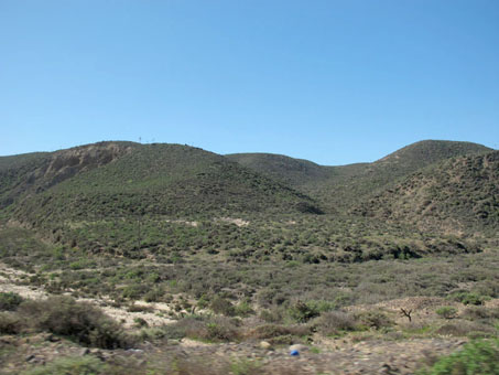
The green hills started in earnest about here, where the Transpeninsular Highway turns inland from the coast and heads towards El Rosario and the Central Desert.
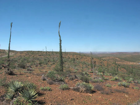
On the Cuesta La Turquesa, around Km 90 marker SE of El Rosario.
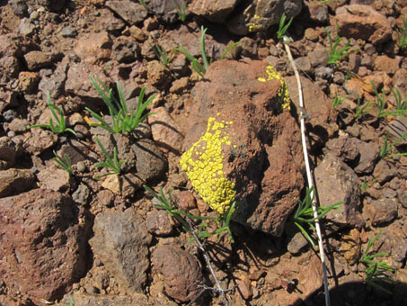
Lichens provide splashes of color on the dark, volcanic rocks. Likely Bright Cobblestone Lichen (Acarospora socialis).
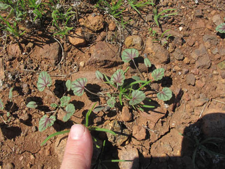
There were lots of new sprouts on the grade. This looks to be something in the Buckwheat family. Rain had passed through about a week or two before.
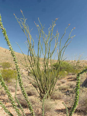
Ocotillos (Fouquieria splendens) fully leafed out. They do much of their photosynthesis in their cortex.
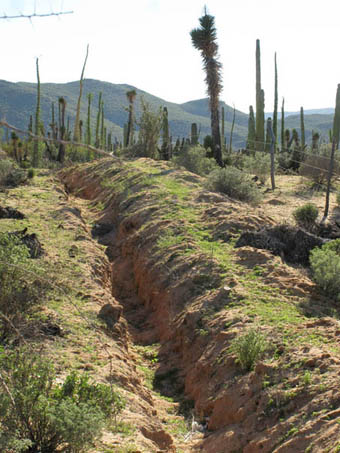
Near the town of Punta Prieta, BC, in the southern end of the Central Desert, the ground was blushing everywhere with new sprouts. The hills in the distance were deep green as well.
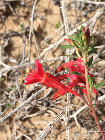
Vizcaino Xylonagra (Xylonagra arborea subsp. wigginsii, Onagraceae) is an shrub endemic to the Central and Vizcaino Deserts.
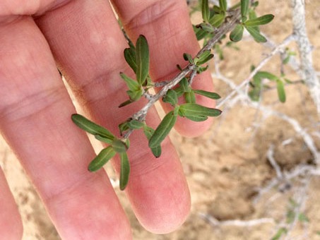
Vizcaino Xylonagra. The leaves are thick & about 5-7 mm L.
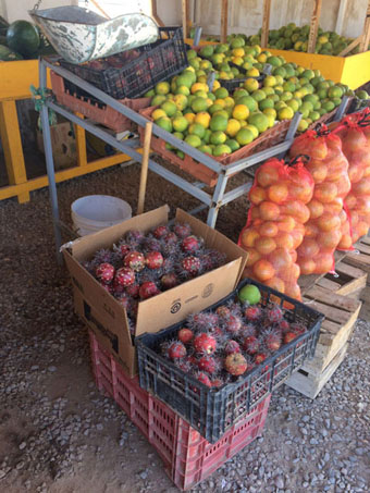
Vizcaino fruit stand with regional produce. Not pictured are local figs and dates from nearby San Ignacio.
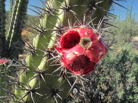
Pitahaya agria / Galloping Cactus (Stenocereus gummosus) with partially eaten fruit.
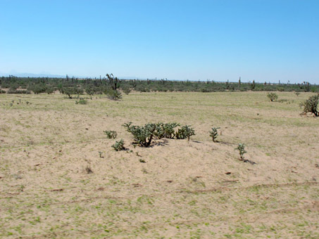
The moisture from both Rosa and Sergio has brought new growth across the floor of the Vizcaino Desert in many places.
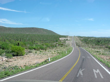
Km 90 north of San Ignacio, along the path of Sergio.
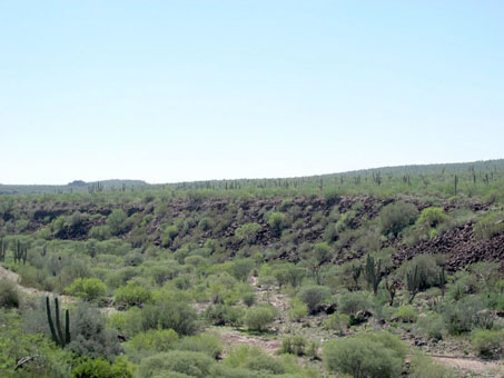
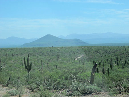
A sea of green, heading into San Ignacio.
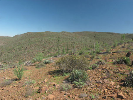
On the Cuesta La Turquesa (La Turquesa Grade), the vegetation shows the transition zone (ecotone) where elements of the coastal scrub and desert scrub are intermixed.
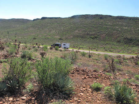
Very little traffic going south. The isolation and silence is refreshing.
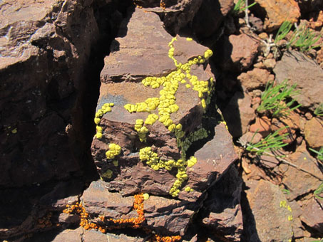
Orange and yellow lichens are common in the area (Bright Cobblestone Lichen with a Firedot Lichen (Caloplaca sp.).
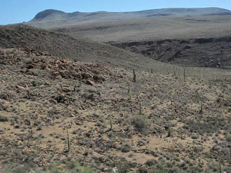
A few hours to the south, the scenery was quite different. The Cirios/Boojums (Fouquieria columnaris) were densely leafy in many places, but the surrounding vegetation, while dry, was multicolored.
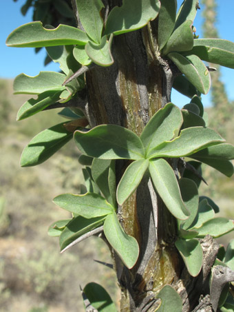
Lots of leaves but no blooms this time of year. The green, cortical, photosynthetic tissue can be seen.
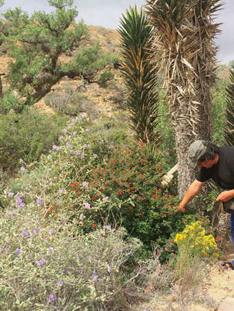
Near Km 66 and El Tomatal, BC, at the northern limit of the Vizcaino Desert, the purple Mariola (Solanum hindsianum), red Tabardillo/Fairy Duster (Calliandra californica), and yellow Romerillo Amargo (Gundlachia diffusa) were in full color.
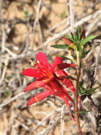
The scarlet flowers are about 20-25 mm L, with the 4 spatulate petals (each about 10 mm L) inserted on the rim of a funnel-shaped hypanthium. The 4 sepals are reflexed & about 15 mm L.
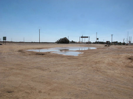
Vestiges of the rain from tropical storm Rosa that passed north of Guerrero Negro at the beginning of October, and Sergio that passed across the peninsula to the south on Oct. 9th, (almost 2 weeks ago).
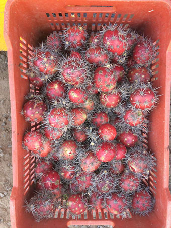
Fruit of Pitahaya agria cactus (Stenocereus gummosus). They are eaten fresh or made into drinks, including smoothies and aguas frescas.
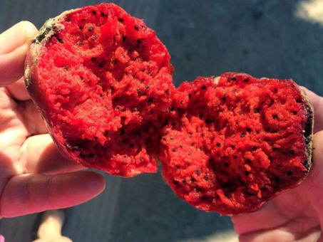
The inside of a pitahaya. The fruit is moist, mildly sweet and refreshing, somewhat similar in texture to a watermelon.
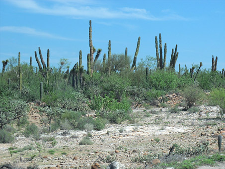
Shrubs have leafed out and are quite full from Guerrero Negro south to San Ignacio.
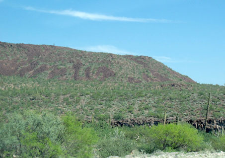
Getting closer to San Ignacio. The effects of Rosa are still evident.
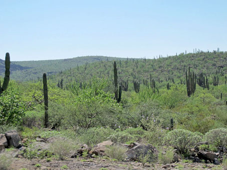

Gulf Coast
As we headed east from San Ignacio, the greenery continued for a number of miles. However, once we descended the peninsular range escarpment and passed el Volcán de las Tres Vírgenes, the landscape began to change, becoming increasingly drier and less bright green. By the time we reached Santa Rosalía, it was obvious that though it had rained on and off during the summer, the moisture had not lingered along the coast. The sierras that formed the escarpment, however, were still quite green. I can´t wait to get up into the mountains while there is still the promise of lots of water in the arroyos and maybe even mosses and ferns.
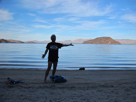
Finally, the beach! Late October and the water was still bathtub warm, the air temperature in the mid 80s with 60-70% humidity.

One of our resident House Geckos, in a rare showing, seemed to be welcoming us home. Moving around the house, we've seen them briefly hanging on the walls or window sills. We have all sizes, from babies to adults, like this one. Locally, they are called besuconas, because their call sounds like loud, smacking kisses.
Revisiting the Ojo de Agua (Headwater of the Mulegé River)
Each season when we return to Mulegé, I never know what I'll find after the summer storms and over-flowing river. In previous posts (Jun 2013, Jan 2015, Dec 2017, Jan 2018), I've documented changes to an area of palm orchards along the Mulegé River referred to as the oasis and Ojo de Agua. Last spring when we left, there was a thriving wetland filled with Bulrush, Cattails, and a mix of sedges and grass, stemodia, rock daisies and the like. I was in no way expecting what I found when we stopped by on one of our first few days back in town.
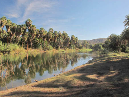
From what I was able to find out from a local goat rancher, someone in charge decided to close the gate on the dam in order to allow the water to back up into the oasis to help the ranchers with watering their animals.
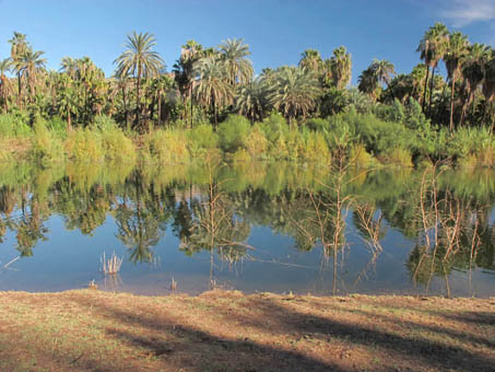
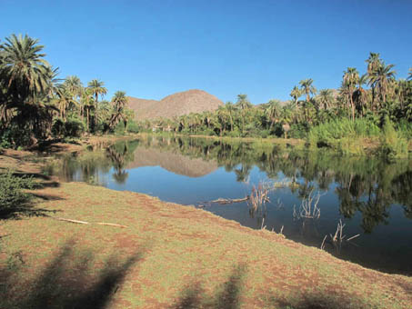
Where the vegetation of the wetland used to be. Almost everything submerged is dead along the bank. See it from earlier this year.
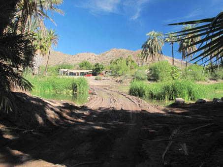
The road crossing the area was mush, with water extending from beyond here on the left of the road and to the right...
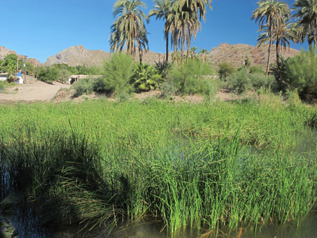
Cattails (Typha dominguensis) and Bulrush (Schoenoplectus americanus) are growing this October where there were just a few sedges in April when we left.
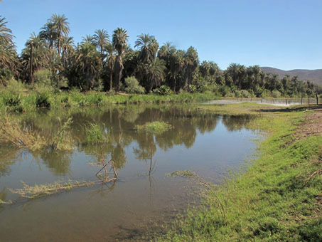
By April, the dominant grass here was Paspalum pubiflorum, but now, the edges are being colonized by Bermuda grass.
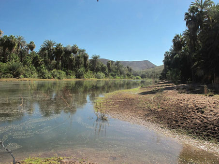
Apparently the dam chute is being opened and closed at times to encourage some flow. Meanwhile, it's a great mosquito (and dengue fever) breeding ground.
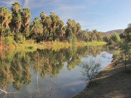
The result was a flooding of the wetland area under what looks to be about 3-4 feet in some areas with a widening of the river. See last January's images here. The plants in the water were those along the bank in the spring.
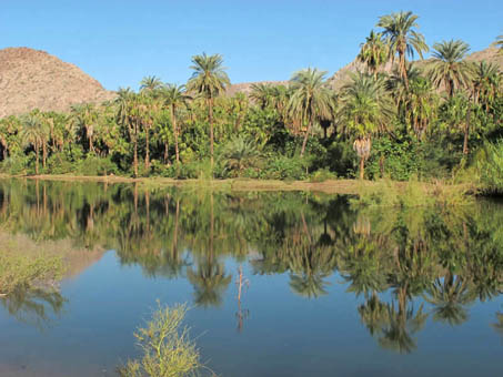
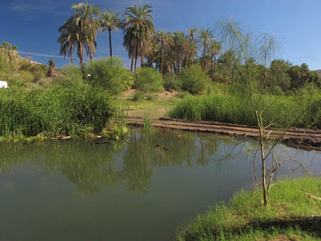
The western end of the area is also underwater, including the road that usually passes through. This end is heavily covered with bulrush and Cattails, and some prostrate species like Bacopa monnieri and Bermuda grass (Cynodon dactylon) are doing well.
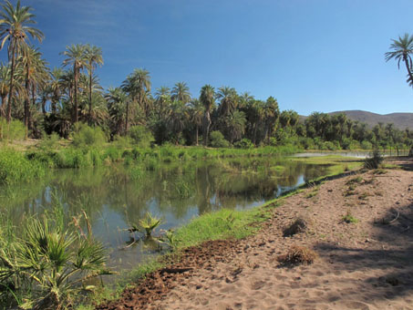
Looking downstream towards the Ojo where everything is now flooded, with water extending from the road (photo left) all the way to the dam about 500-750 yards away.
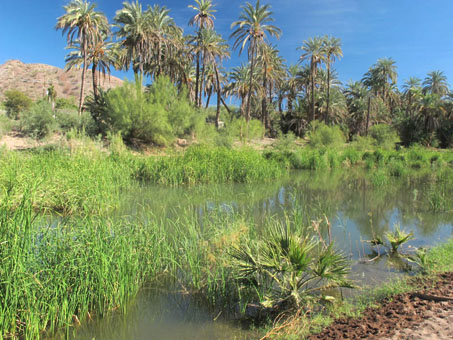
Cattails and Bulrush, as well as a few fan palms (Washingtonia robustus).
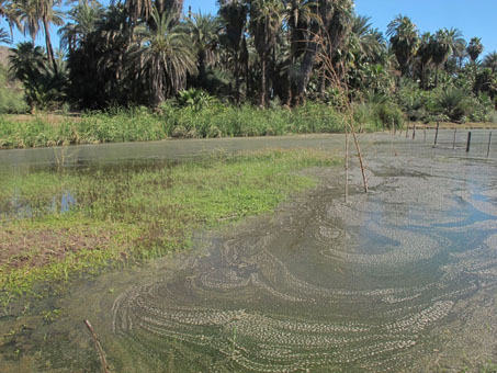
The pools are stagnant in many parts, even though water can be seen bubbling up from the stream bed.
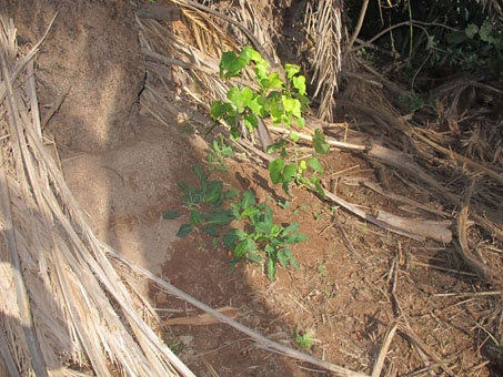
Deeper in the oasis area, the water table, which is already quite high, now seems more saturated and the soil is visibly damp, leading to more grasses and forbs under the palms.
That's it for this month, but stay tuned for next month's entry which will cover my recent trip up into the sierras to the west of Mulegé. Until then, hasta la próxima…
Debra Valov—Curatorial Volunteer


